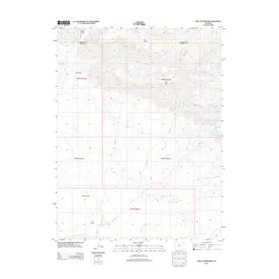
2013 Map of Ruby Lee Reservoir
USGS Topo · Published 2013About this map
The Book Cliffs dominate the northern landscape of this Mesa County quadrangle, where the arid terrain of western Colorado is carved by a network of seasonal drainages. Water management is central to the area's geography, anchored by the Ruby Lee Reservoir and the Ruby-Ditch. In the lower elevations, the Government Highline Canal cuts across the southwest, marking the transition from the high desert ridges to the irrigated valley lands. A series of significant washes, including Big Salt Wash, Lipan Wash, and Layton Wash, define the drainage patterns flowing south from the highlands. Small-scale topographical features like Coal Gulch, Stove Canyon, and Dry Hollow speak to the erosion-carved character of the region near the Garfield County line.
Find a feature on this map
28 named features on this map. Tap any name to fly to it.
Don’t see what you’re looking for? This feature index may not catch every label — zoom into the map to look around manually.
Map Details
Editions of this 2013 Ruby Lee Reservoir Map
This is the sole edition of this map. No revisions or reprints were ever made.
Other maps of this area

1956 · Grand Junction
USGS Topo · 1:250,000

1959 · Grand Junction
USGS Topo · 1:250,000

1960 · Grand Junction
USGS Topo · 1:250,000

1962 · Grand Junction
USGS Topo · 1:250,000

1962 · Fruita
USGS Topo · 1:24,000

1962 · Mack
USGS Topo · 1:24,000

1962 · Corcoran Point
USGS Topo · 1:24,000

1964 · Grand Junction
USGS Topo · 1:250,000

1965 · Grand Junction
USGS Topo · 1:250,000
1968 · Howard Canyon
USGS Topo · 1:24,000