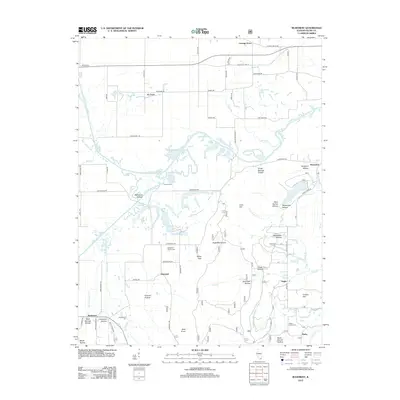
2012 Map of Rudement
USGS Topo · Published 2012About this map
The Eagle Mountains dominate the southern portion of this region, where high points like Stone Face and Bald Knob overlook a landscape carved by the Saline River and its various forks. This survey reveals a pattern of dispersed rural settlements, including Rudement, Somerset, and Cottage Grove, connected by a network of winding roads and hollows. Local family history is preserved at numerous small burial sites such as Big Saline Church Cem, Colbert Family Cem, and Blockhouse Cem. The hydrology is particularly complex north of the mountains, defined by slow-moving features like Davis Slough and Setten Slough alongside the Middle Fork Saline River. Natural landmarks like Grocery Ford and the many named hollows, including Stillhouse Hollow and Rocky Branch Hollow, indicate a long history of local navigation through the dense drainage systems and high ridges of Saline County.
Find a feature on this map
80 named features on this map. Tap any name to fly to it.
Don’t see what you’re looking for? This feature index may not catch every label — zoom into the map to look around manually.
Map Details
Editions of this 2012 Rudement Map
This is the sole edition of this map. No revisions or reprints were ever made.
Other maps of this area

1905 · Eldorado
USGS Topo · 1:62,500

1906 · Eldorado
USGS Topo · 1:62,500

1908 · Galatia
USGS Topo · 1:62,500

1916 · Equality
USGS Topo · 1:62,500

1925 · Harrisburg
USGS Topo · 1:62,500

1938 · Galatia
USGS Topo · 1:62,500

1939 · Harrisburg
USGS Topo · 1:62,500

1949 · Paducah
USGS Topo · 1:250,000

1950 · Paducah
USGS Topo · 1:250,000

1954 · Paducah
USGS Topo · 1:250,000