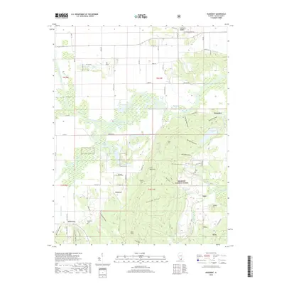
2018 Map of Rudement
USGS Topo · Published 2018About this map
Shawnee National Forest dominates the southern half of this landscape, where the flat plains of the Saline River basin give way to the prominent Eagle Mountains. This 2018 survey reveals a terrain defined by deep drainage patterns like Dennison Hollow and Flatrock Hollow, alongside numerous family-named landmarks including Colbert Hill and Horton Hill. The settlement pattern is dispersed, with small communities like Somerset and Rudement serving as anchors for the surrounding rural road network. Genealogists will find significant value in the mapped locations of several burial sites, such as the Big Saline Church Cem and the remote Colbert Family Cem. Water is a defining element throughout, from the meandering South Fork Saline River to recreational points like Glen Jones Lake and the wetlands of Settlen Slough.
Find a feature on this map
89 named features on this map. Tap any name to fly to it.
Don’t see what you’re looking for? This feature index may not catch every label — zoom into the map to look around manually.
Map Details
Editions of this 2018 Rudement Map
This is the sole edition of this map. No revisions or reprints were ever made.
Other maps of this area

1905 · Eldorado
USGS Topo · 1:62,500

1906 · Eldorado
USGS Topo · 1:62,500

1908 · Galatia
USGS Topo · 1:62,500

1916 · Equality
USGS Topo · 1:62,500

1925 · Harrisburg
USGS Topo · 1:62,500

1938 · Galatia
USGS Topo · 1:62,500

1939 · Harrisburg
USGS Topo · 1:62,500

1949 · Paducah
USGS Topo · 1:250,000

1950 · Paducah
USGS Topo · 1:250,000

1954 · Paducah
USGS Topo · 1:250,000