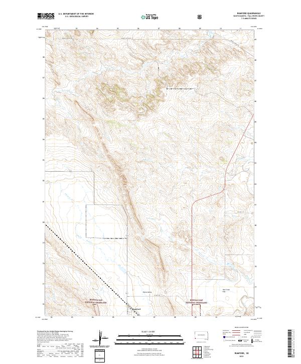
2021 Map of Rumford
USGS Topo · Published 2021About this map
Rumford is the primary settlement in this corner of Fall River County, situated at the junction of Rumford Rd and Co Hwy 78. The landscape is dominated by the expansive Buffalo Gap National Grassland, which preserves the open character of the South Dakota prairie. The terrain transitions from the distinct Plains Valley toward the more level Hat Creek Flat in the southeast. A network of drainages including Plum Cr, Piney Cr, and Horse Cr carve subtle pathways through the grassland, reflecting the natural hydrology that shaped early ranching and travel routes. Notable local arteries like Indian Canyon Rd and Co Hwy 71F connect these remote reaches, providing a clear view of the modern land divisions and access points in this rural environment.
Find a feature on this map
20 named features on this map. Tap any name to fly to it.
Don’t see what you’re looking for? This feature index may not catch every label — zoom into the map to look around manually.
Map Details
Editions of this 2021 Rumford Map
This is the sole edition of this map. No revisions or reprints were ever made.
Other maps of this area

1902 · Edgemont
USGS Topo · 1:125,000

1950 · Edgemont
USGS Topo · 1:24,000

1950 · Heppner
USGS Topo · 1:24,000

1950 · Cascade Springs
USGS Topo · 1:24,000

1950 · Rumford
USGS Topo · 1:24,000

1950 · Flint Hill
USGS Topo · 1:24,000

1955 · Hot Springs
USGS Topo · 1:250,000
1982 · Crowe Dam
USGS Topo · 1:25,000
1982 · Provo
USGS Topo · 1:25,000
1982 · Ardmore
USGS Topo · 1:25,000