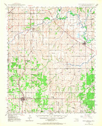
1949 Map of Rush Springs
USGS Topo · Published 1967About this map
The Washita River and Little Washita River dominate the northern landscape of this Grady County region, where a complex network of levees protects the fertile bottomlands near Ninnekah. This 1949 survey illustrates a rural Oklahoma economy still deeply rooted in local school districts and river-valley agriculture. The Chicago Rock Island and Pacific RR serves as a primary transit corridor, linking the southern hub of Rush Springs to northern settlements like Norge.
Find a feature on this map
49 named features on this map. Tap any name to fly to it.
Don’t see what you’re looking for? This feature index may not catch every label — zoom into the map to look around manually.
Map Details
Editions of this 1949 Rush Springs Map
2 editions found
Other maps of this area

1902 · Rush Springs
USGS Topo · 1:125,000

1904 · Chickasha
USGS Topo · 1:125,000

1945 · Anadarko
USGS Topo · 1:62,500

1949 · Cement
USGS Topo · 1:62,500

1949 · Nellie
USGS Topo · 1:62,500

1949 · Rush Springs
USGS Topo · 1:62,500

1950 · Rush Springs
USGS Topo · 1:62,500

1950 · Marlow
USGS Topo · 1:62,500

1951 · Marlow
USGS Topo · 1:62,500

1954 · Oklahoma City
USGS Topo · 1:250,000