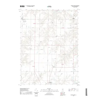
2018 Map of Rushville North
USGS Topo · Published 2018About this map
Littleton and Oakland Center anchor this rural landscape in Schuyler County, where the terrain is deeply etched by a complex drainage system flowing toward the Illinois River basin. The map reveals a high density of small family and community burial grounds, such as Sugar Grove North Cem and Gillenwater Cem, which are invaluable for genealogical research into the region’s early settler families. The township lines of t3n r2w and t3n r1w organize a grid of country roads, including Old Macomb Rd and Log Cabin Rd, that navigate the ridges between numerous waterways like Brushy Cr and McKee Br. This 2018 survey captures the persistent agricultural character of the area just north of Rushville, illustrating how modern infrastructure follows the same high-ground paths established by 19th-century pioneers.
Find a feature on this map
86 named features on this map. Tap any name to fly to it.
Don’t see what you’re looking for? This feature index may not catch every label — zoom into the map to look around manually.
Map Details
Editions of this 2018 Rushville North Map
This is the sole edition of this map. No revisions or reprints were ever made.
Other maps of this area

1912 · Macomb
USGS Topo · 1:62,500

1914 · Macomb
USGS Topo · 1:62,500

1918 · Vermont
USGS Topo · 1:62,500

1921 · Vermont
USGS Topo · 1:62,500

1923 · Rushville
USGS Topo · 1:62,500

1926 · Beardstown
USGS Topo · 1:62,500

1926 · Rushville
USGS Topo · 1:62,500

1944 · Beardstown
USGS Topo · 1:62,500

1947 · Vermont
USGS Topo · 1:24,000
1948 · Vermont
USGS Topo · 1:24,000