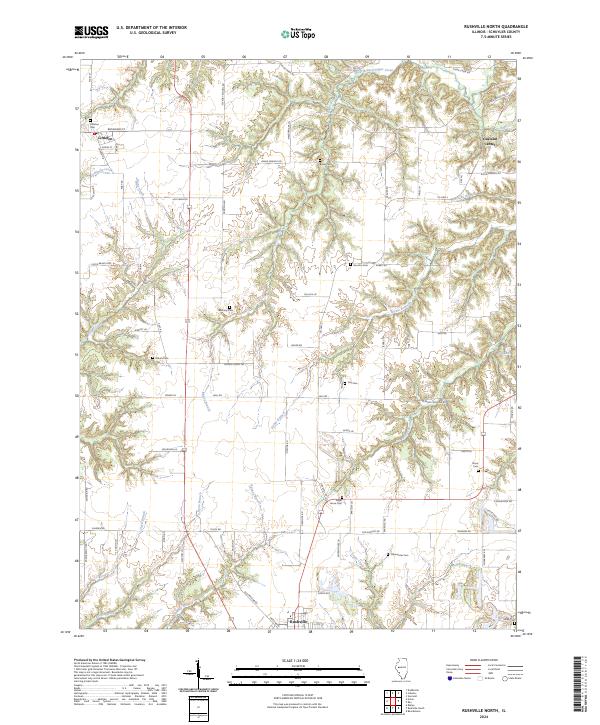
2024 Map of Rushville North
USGS Topo · Published 2024About this map
The rolling agricultural landscape of northern Schuyler County is defined by the headwaters of numerous creeks, including West Branch Sugar Creek and Brushy Creek. The settlement of Littleton anchors the northwest, while the northern edge of Rushville enters the frame at the southern margin. This area is notably dense with small family and community burial grounds, providing a significant resource for genealogical research. Documented sites include Littleton Cem, Bauer Cem, Sugar Grove Cem, and Moore Cem, often situated near the breaks of the many timbered draws. A complex network of rural routes like Log Cabin Rd and Moore Chapel Rd connects these points across the dissected terrain, illustrating a persistent pattern of rural habitation. The northeast corner is marked by Oakland Center, while water features like Gill Lake and Richie Branch drain the central valleys.
Find a feature on this map
78 named features on this map. Tap any name to fly to it.
Don’t see what you’re looking for? This feature index may not catch every label — zoom into the map to look around manually.
Map Details
Editions of this 2024 Rushville North Map
This is the sole edition of this map. No revisions or reprints were ever made.
Other maps of this area

1912 · Macomb
USGS Topo · 1:62,500

1914 · Macomb
USGS Topo · 1:62,500

1918 · Vermont
USGS Topo · 1:62,500

1921 · Vermont
USGS Topo · 1:62,500

1923 · Rushville
USGS Topo · 1:62,500

1926 · Beardstown
USGS Topo · 1:62,500

1926 · Rushville
USGS Topo · 1:62,500

1944 · Beardstown
USGS Topo · 1:62,500

1947 · Vermont
USGS Topo · 1:24,000
1948 · Vermont
USGS Topo · 1:24,000