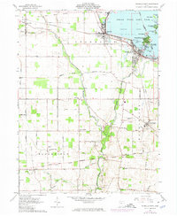
1961 Map of Russells Point
USGS Topo · Published 1974About this map
Indian Lake and its complex archipelago of islands define the landscape of this Logan County region during the early 1960s. The map illustrates a vibrant lakeside economy centered on Russells Point and Lakeview, where numerous islands like Wolf Island, Orchard Island, and Paradise Island are subdivided for development. This resort atmosphere transitions abruptly into the agricultural grid of Stokes and Bloomfield townships, where the Indian Treaty Boundary and Greenville Treaty Line still dictate the orientation of farm roads and property lines. The course of the Great Miami River winds south from the lake, passing through a corridor of gravel operations and small rural communities. Local history is anchored by sites like Muchinippi Ch, Plum Cem, and the village of Lewistown, which sits at the confluence of the river and Muchinippi Creek. The Penn Central railroad cuts through the terrain, connecting these agrarian settlements to the broader Ohio industrial network.
Find a feature on this map
63 named features on this map. Tap any name to fly to it.
Don’t see what you’re looking for? This feature index may not catch every label — zoom into the map to look around manually.
Map Details
Editions of this 1961 Russells Point Map
Other maps of this area

1906 · Lima
USGS Topo · 1:62,500

1913 · Alger
USGS Topo · 1:48,000

1913 · Bellefontaine
USGS Topo · 1:48,000

1913 · Sidney
USGS Topo · 1:62,500

1915 · Alger
USGS Topo · 1:62,500

1915 · Bellefontaine
USGS Topo · 1:62,500

1943 · Alger
USGS Topo · 1:62,500

1944 · Sidney
USGS Topo · 1:62,500

1944 · Bellefontaine
USGS Topo · 1:62,500

1950 · Marion
USGS Topo · 1:250,000