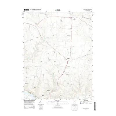
2013 Map of Russellville
USGS Topo · Published 2013About this map
Russellville serves as the primary hub in this portion of Brown County, where the intersection of Us-62 and Oh-125 anchors a landscape of small agricultural settlements and family-named ridges. The terrain is deeply carved by water, with Straight Creek and Redoak Cr cutting through the uplands as they flow south toward the Ohio River. This 2013 survey is particularly valuable for genealogists, as it meticulously identifies numerous small burial grounds, including the Devore Family Cem, Dye Cem, and Martin Cem, which are often tucked away on private land far from the main roads. Near the river, the village of Ripley sits along the southern border, while smaller hamlets like Stringtown and Redoak mark the transition between the rolling highlands and the river valley. The map clearly illustrates the historical pattern of development along the many named hollows, such as Mefford Hollow and Chicken Hollow, where local farming families established their roots.
Find a feature on this map
91 named features on this map. Tap any name to fly to it.
Don’t see what you’re looking for? This feature index may not catch every label — zoom into the map to look around manually.
Map Details
Editions of this 2013 Russellville Map
This is the sole edition of this map. No revisions or reprints were ever made.
Other maps of this area

1915 · Maysville
USGS Topo · 1:62,500

1918 · Seaman
USGS Topo · 1:62,500

1919 · Maysville
USGS Topo · 1:62,500

1928 · Higginsport
USGS Topo · 1:48,000

1929 · Springdale
USGS Topo · 1:48,000

1931 · Higginsport
USGS Topo · 1:62,500

1935 · Springdale
USGS Topo · 1:62,500

1952 · Maysville East
USGS Topo · 1:24,000

1952 · Germantown
USGS Topo · 1:24,000

1952 · Higginsport
USGS Topo · 1:24,000