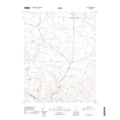
2019 Map of Russellville
USGS Topo · Published 2019About this map
Russellville and Redoak anchor this southern Ohio landscape, where the terrain transitions toward the Ohio River at the southern boundary. This 2019 survey documents a deeply dissected plateau, where prominent features like Hillman Ridge and Dixon Ridge are carved by numerous waterways including Straight Creek and Washburn Run. The settlement pattern follows the high ground of the ridges and the primary corridor of Us Rte 68, which links Stringtown to the northern villages. For genealogists, the map provides precise locations for family and community landmarks such as the Devore Family Cem, Old Redoak Cem, and the Associated Reformed Churchyard. These burial sites, alongside local identifiers like Chicken Hollow and Kope Hollow, preserve the 19th-century nomenclature of the rural farmsteads that established Brown County.
Find a feature on this map
95 named features on this map. Tap any name to fly to it.
Don’t see what you’re looking for? This feature index may not catch every label — zoom into the map to look around manually.
Map Details
Editions of this 2019 Russellville Map
This is the sole edition of this map. No revisions or reprints were ever made.
Other maps of this area

1915 · Maysville
USGS Topo · 1:62,500

1918 · Seaman
USGS Topo · 1:62,500

1919 · Maysville
USGS Topo · 1:62,500

1928 · Higginsport
USGS Topo · 1:48,000

1929 · Springdale
USGS Topo · 1:48,000

1931 · Higginsport
USGS Topo · 1:62,500

1935 · Springdale
USGS Topo · 1:62,500

1952 · Maysville East
USGS Topo · 1:24,000

1952 · Germantown
USGS Topo · 1:24,000

1952 · Higginsport
USGS Topo · 1:24,000