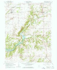
1963 Map of Russellville
USGS Topo · Published 1977About this map
Russellville serves as the primary hub of this west-central Indiana landscape, situated along the Baltimore and Ohio rail line near the Montgomery and Putnam County line. The terrain is defined by the winding course of Big Raccoon Creek, which feeds into the substantial waters of Cecil M Harden Lake. This reservoir significantly alters the drainage patterns of local tributaries like Ramp Creek and Peters Creek, creating a distinctive shoreline that contrasts with the surrounding agricultural grid.
Find a feature on this map
37 named features on this map. Tap any name to fly to it.
Don’t see what you’re looking for? This feature index may not catch every label — zoom into the map to look around manually.
Map Details
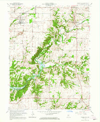
Editions of this 1963 Russellville Map
2 editions found
Other maps of this area

1949 · Alamo
USGS Topo · 1:24,000

1951 · Clinton Falls
USGS Topo · 1:24,000

1951 · Mansfield
USGS Topo · 1:24,000

1953 · Indianapolis
USGS Topo · 1:250,000

1955 · Russellville
USGS Topo · 1:24,000

1956 · Indianapolis
USGS Topo · 1:250,000

1956 · New Market
USGS Topo · 1:24,000

1957 · Indianapolis
USGS Topo · 1:250,000

1958 · Roachdale
USGS Topo · 1:24,000

1958 · Ladoga
USGS Topo · 1:24,000