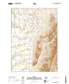
2017 Map of Russian Mission A-4 SE
USGS Topo · Published 2017About this map
Mary Lou Gulch carves through the high, corrugated ridges on the eastern side of this map, providing a singular named landmark in a landscape dominated by the transition from steep uplands to a water-saturated western plain. The terrain is divided between the sharp elevation of the eastern highlands and the low-lying wetlands to the west, where countless unnamed ponds and small lakes dot the surface. This 2017 survey reflects the enduring wild character of the Bethel Census Area within the Public Land Survey System grids of t12n r62w, t12n r61w, t11n r62w, and t11n r61w. The stark contrast between the vertical relief of the gulch and the nearly level lake country reveals the distinct geomorphology of this portion of the Russian Mission region.
Find a feature on this map
5 named features on this map. Tap any name to fly to it.
Don’t see what you’re looking for? This feature index may not catch every label — zoom into the map to look around manually.
Map Details
Editions of this 2017 Russian Mission A-4 SE Map
This is the sole edition of this map. No revisions or reprints were ever made.
Other maps of this area

1947 · Russian Mission
USGS Topo · 1:250,000

1950 · Russian Mission
USGS Topo · 1:250,000

1950 · Bethel
USGS Topo · 1:250,000

1954 · Russian Mission A-4
USGS Topo · 1:63,360

1954 · Bethel D-4
USGS Topo · 1:63,360

1954 · Russian Mission A-3
USGS Topo · 1:63,360

1954 · Bethel D-3
USGS Topo · 1:63,360

1980 · Russian Mission
USGS Topo · 1:250,000

1980 · Bethel
USGS Topo · 1:250,000
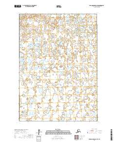
2017 · Russian Mission A-4 SW
USGS Topo · 1:25,000