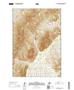
2019 Map of Russian Mission D-1 SW
USGS Topo · Published 2019About this map
Owhat River meanders across this landscape in the Bethel Census Area, defining the hydrology of a region where water and elevation dictate the rhythm of the land. The presence of Molybdenum Mtn stands as a prominent topographical landmark among the surrounding hills and ridges. This 2019 survey documents a wilderness environment defined by natural drainages rather than human infrastructure, offering a clear record of the area's physical geography. The map provides precise detail of the varying elevations and the intricate system of smaller tributaries that feed into the main river channel, which is essential for understanding the environmental context of this portion of Alaska.
Find a feature on this map
8 named features on this map. Tap any name to fly to it.
Don’t see what you’re looking for? This feature index may not catch every label — zoom into the map to look around manually.
Map Details
Editions of this 2019 Russian Mission D-1 SW Map
This is the sole edition of this map. No revisions or reprints were ever made.
Other maps of this area

1947 · Russian Mission
USGS Topo · 1:250,000

1950 · Russian Mission
USGS Topo · 1:250,000

1952 · Russian Mission D-2
USGS Topo · 1:63,360

1952 · Russian Mission C-1
USGS Topo · 1:63,360

1952 · Russian Mission D-1
USGS Topo · 1:63,360

1952 · Russian Mission C-2
USGS Topo · 1:63,360

1980 · Russian Mission
USGS Topo · 1:250,000
2019 · Russian Mission C-1 NW
USGS Topo · 1:25,000
2019 · Russian Mission D-2 SE
USGS Topo · 1:25,000
2019 · Russian Mission D-1 NE
USGS Topo · 1:25,000