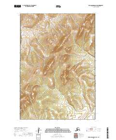
2019 Map of Russian Mission D-1 NE
USGS Topo · Published 2019About this map
Bethel Census Area's interior landscape is defined by its topographic complexity and lack of formal human infrastructure in this 2019 survey. The quadrangle is organized by the Public Land Survey System grids of t22n r54w, t22n r53w, t21n r54w, and t21n r53w, which provide the only navigational framework for this remote territory. The terrain is characterized by a dense network of wetlands and significant elevation changes, with contours rising to nearly 1500 feet in several sectors. Without named settlements, schools, or roads, the map serves as a primary record of the natural hydrology and drainage patterns of the Alaskan wilderness. Researchers and land managers rely on these specific township and range designations to identify terrain features where traditional place names are absent.
Find a feature on this map
4 named features on this map. Tap any name to fly to it.
Don’t see what you’re looking for? This feature index may not catch every label — zoom into the map to look around manually.
Map Details
Editions of this 2019 Russian Mission D-1 NE Map
This is the sole edition of this map. No revisions or reprints were ever made.
Other maps of this area

1947 · Russian Mission
USGS Topo · 1:250,000

1950 · Russian Mission
USGS Topo · 1:250,000

1950 · Sleetmute
USGS Topo · 1:250,000

1951 · Holy Cross
USGS Topo · 1:250,000

1951 · Iditarod
USGS Topo · 1:250,000

1952 · Holy Cross A-1
USGS Topo · 1:63,360

1952 · Holy Cross
USGS Topo · 1:250,000

1952 · Russian Mission D-1
USGS Topo · 1:63,360
1954 · Sleetmute D-8
USGS Topo · 1:63,360

1954 · Iditarod A-6
USGS Topo · 1:63,360