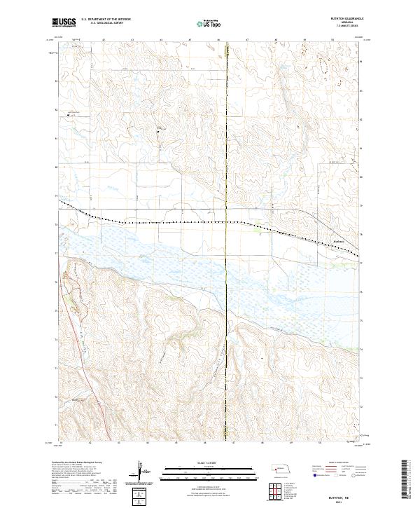
2021 Map of Ruthton
USGS Topo · Published 2021About this map
Ash Hollow and Windlass Hill dominate the southwestern portion of this landscape, marking a terrain defined by the descent toward the North Platte River. This 2021 survey reveals a complex network of historic and modern routes, including the Overland Trl, Medicine Wheel Trl, and Access Road Trl, which trace the high ground above the canyon systems. The North Platte River serves as a central hydrological axis, flanked by an intricate system of irrigation canals such as the Blue Cr Canal and Graf Canal.
Find a feature on this map
39 named features on this map. Tap any name to fly to it.
Don’t see what you’re looking for? This feature index may not catch every label — zoom into the map to look around manually.
Map Details
Editions of this 2021 Ruthton Map
This is the sole edition of this map. No revisions or reprints were ever made.
Other maps of this area

1897 · Ogallala
USGS Topo · 1:125,000

1900 · Chappell
USGS Topo · 1:125,000

1900 · Ogallala
USGS Topo · 1:125,000

1954 · Scottsbluff
USGS Topo · 1:250,000

1954 · North Platte
USGS Topo · 1:250,000

1956 · North Platte
USGS Topo · 1:250,000

1957 · North Platte
USGS Topo · 1:250,000

1958 · Scottsbluff
USGS Topo · 1:250,000

1967 · North Platte
USGS Topo · 1:250,000
1971 · Brule NW
USGS Topo · 1:24,000