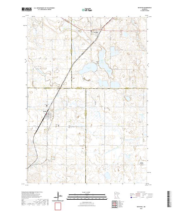
2022 Map of Ruthton
USGS Topo · Published 2022About this map
Ruthton and Florence anchor this agricultural landscape in southwestern Minnesota, positioned along the prominent geographic rise of the Coteau des Prairies. The terrain is defined by a complex network of glacial lakes and drainage systems, including East Twin Lake, West Twin Lake, and the dry Ivadelle Lakebed. The upper reaches of the Redwood River meander through the southern half of the map, supplemented by engineered waterways like Judicial Ditch Number Thirteen and County Ditch Number Sixteen. This survey highlights the intersection of four counties—Lincoln, Lyon, Pipestone, and Murray—where the town of Ruthton sits just west of the Railroad Ave corridor. Family history researchers will find several well-placed burial sites, such as Opdal Cem north of Florence and Peace Cem situated southeast of the Ruthton village center.
Find a feature on this map
63 named features on this map. Tap any name to fly to it.
Don’t see what you’re looking for? This feature index may not catch every label — zoom into the map to look around manually.
Map Details
Editions of this 2022 Ruthton Map
This is the sole edition of this map. No revisions or reprints were ever made.
Other maps of this area

1953 · Watertown
USGS Topo · 1:250,000

1953 · New Ulm
USGS Topo · 1:250,000

1957 · New Ulm
USGS Topo · 1:250,000

1958 · New Ulm
USGS Topo · 1:250,000

1958 · Watertown
USGS Topo · 1:250,000

1963 · Dead Coon Lake
USGS Topo · 1:24,000

1963 · Russell
USGS Topo · 1:24,000

1963 · Tyler
USGS Topo · 1:24,000

1967 · New Ulm
USGS Topo · 1:250,000
1967 · Ruthton
USGS Topo · 1:24,000