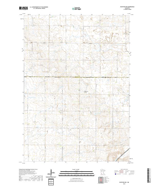
2022 Map of Ruthton NW
USGS Topo · Published 2022About this map
Coteau des Prairies defines the physical character of this southwest Minnesota landscape, where the high plateau forms a significant drainage divide. This 2022 survey captures the headwaters of multiple regional waterways, including the Redwood River flowing toward the northeast and the Rock River heading south. The terrain is marked by the distinct boundary between Lincoln and Pipestone Counties, illustrating how geopolitical lines follow the natural contours of the land. The mapping of E Br Flandreau Cr and N Br Pipestone Cr provides a contemporary look at the intricate hydrography of the region, while the grid of rural roads like Co Rd 9 and Co Rd 12 shows the enduring township and range system that has organized this agricultural territory since the original land surveys.
Find a feature on this map
30 named features on this map. Tap any name to fly to it.
Don’t see what you’re looking for? This feature index may not catch every label — zoom into the map to look around manually.
Map Details
Editions of this 2022 Ruthton NW Map
This is the sole edition of this map. No revisions or reprints were ever made.
Other maps of this area

1953 · Watertown
USGS Topo · 1:250,000

1958 · Watertown
USGS Topo · 1:250,000

1963 · Dead Coon Lake
USGS Topo · 1:24,000

1963 · Tyler
USGS Topo · 1:24,000

1967 · Pipestone North
USGS Topo · 1:24,000
1967 · Ruthton
USGS Topo · 1:24,000

1967 · Ruthton NW
USGS Topo · 1:24,000
1967 · Woodstock
USGS Topo · 1:24,000

1967 · Verdi
USGS Topo · 1:24,000

1967 · Lake Benton
USGS Topo · 1:24,000