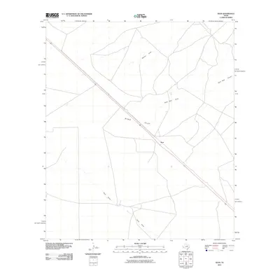
2010 Map of Ryan
USGS Topo · Published 2010About this map
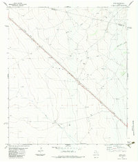
Ryan sits along the path of U.S. Route 90 in this Presidio County landscape, where the high desert terrain is defined by wide expanses and seasonal drainage systems. The map detail highlights Ryan Flat, a significant level area that dominates the central portion of the quadrangle. Transport and topography are closely linked here, as the roadway cuts a straight line across the basin, bypassed by winding ephemeral waterways such as Ryan Draw and Medley Draw. To the northeast, the terrain begins to shift with the appearance of Owls Nest Canyon and its associated Owls Nest Draw. This 2010 survey illustrates the sparse settlement pattern typical of the Trans-Pecos region, focusing on the essential infrastructure of the highway and the natural drainage patterns that dictate the use of the land.
Find a feature on this map
7 named features on this map. Tap any name to fly to it.
Don’t see what you’re looking for? This feature index may not catch every label — zoom into the map to look around manually.
Map Details
Editions of this 2010 Ryan Map
This is the sole edition of this map. No revisions or reprints were ever made.
Other maps of this area

1894 · Valentine
USGS Topo · 1:125,000

1895 · Marfa
USGS Topo · 1:125,000

1897 · Valentine
USGS Topo · 1:125,000

1943 · Valentine
USGS Topo · 1:125,000

1959 · Marfa
USGS Topo · 1:250,000

1965 · Marfa
USGS Topo · 1:250,000
1978 · Valentine East
USGS Topo · 1:24,000
1978 · Paradise Mountain
USGS Topo · 1:24,000
1978 · San Antonio Pass
USGS Topo · 1:24,000
1983 · Ryan
USGS Topo · 1:24,000