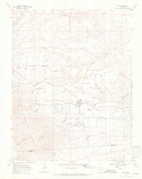
1969 Map of Rye
USGS Topo · Published 1972About this map
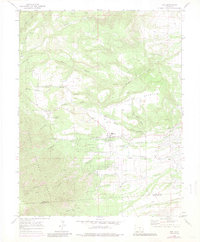
Rye sits at the foot of the mountains where the high plains meet the eastern slope, serving as a hub for this rural Pueblo County landscape in the late 1960s. The settlement is anchored by a High Sch, the Brookside Cem, and a Fish Hatchery along Greenhorn Creek. To the west, the boundary of the San Isabel National Forest marks a transition into more dramatic terrain, characterized by the Huckleberry Hills and the steep grades of Gleason Canyon. The map reveals a community organized around water and recreation, with Cuerna Verde Park and the rugged Bartlett Trail providing access to the higher elevations. Southeast of the main village, the burgeoning development of Colorado City appears, showing a distinct grid pattern that contrasts with the traditional layout of the older settlement at Rye and the surrounding cattle-country canyons.
Find a feature on this map
32 named features on this map. Tap any name to fly to it.
Don’t see what you’re looking for? This feature index may not catch every label — zoom into the map to look around manually.
Map Details
Editions of this 1969 Rye Map
6 editions found
Other maps of this area

1889 · Canon City
USGS Topo · 1:125,000

1889 · Huerfano Park
USGS Topo · 1:125,000

1891 · Walsenburg
USGS Topo · 1:125,000

1891 · Pueblo
USGS Topo · 1:125,000

1892 · Huerfano Park
USGS Topo · 1:125,000

1892 · Canon City
USGS Topo · 1:125,000

1894 · Walsenburg
USGS Topo · 1:125,000

1894 · Pueblo
USGS Topo · 1:125,000

1896 · Pueblo
USGS Topo · 1:125,000

1897 · Pueblo
USGS Topo · 1:125,000