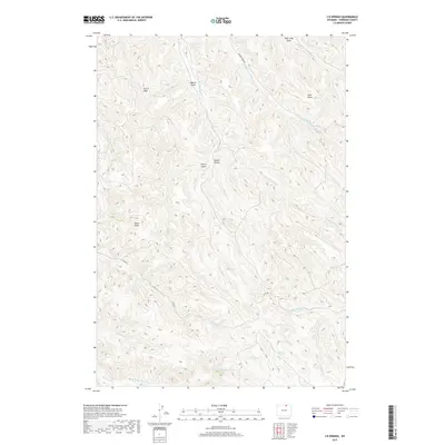
2017 Map of S R Springs
USGS Topo · Published 2017About this map
S R Springs serves as the focal point for this section of Sheridan County, where the high plains are carved by an intricate network of seasonal drainage and named draws. The landscape is defined by the headwaters of the Badger Creek system, including Middle Fork Badger Cr and S Fork Badger Cr, which branch out across the township lines. This 2017 survey reflects the enduring cattle-country character of the region, marked by isolated water sources like Barrel Spring and several prominent geographic features named by early ranchers, such as Upton Gulch, Spear Draw, and Peters Gulch. While few permanent structures are noted, the presence of Badger Creek Rd and Co Rd 86 provides the primary access through these grazing lands, illustrating how modern infrastructure follows the natural corridors between the many draws, such as Mile Long Draw.
Find a feature on this map
26 named features on this map. Tap any name to fly to it.
Don’t see what you’re looking for? This feature index may not catch every label — zoom into the map to look around manually.
Map Details
Editions of this 2017 S R Springs Map
This is the sole edition of this map. No revisions or reprints were ever made.
Other maps of this area
1909 · Sheridan
USGS Topo · 1:125,000
1911 · Sheridan
USGS Topo · 1:125,000

1955 · Sheridan
USGS Topo · 1:250,000

1958 · Sheridan
USGS Topo · 1:250,000

1962 · Sheridan
USGS Topo · 1:250,000
1970 · O T O Ranch
USGS Topo · 1:24,000
1970 · Verona
USGS Topo · 1:24,000
1970 · Ulm
USGS Topo · 1:24,000
1970 · Cedar Canyon
USGS Topo · 1:24,000
1970 · S R Springs
USGS Topo · 1:24,000