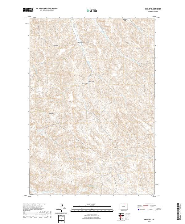
2021 Map of S R Springs
USGS Topo · Published 2021About this map
S R Springs and Barrel Spring mark critical water sources in this section of the Powder River Basin, where a network of drainages defines the high plains landscape. The drainage system is dominated by the forks of Badger Creek, including the Middle Fork Badger Cr, S Fork Badger Cr, and Hill Prong Badger Cr. These waterways, along with Buffalo Cr and Jim Crow Cr, create a deeply incised topography of draws and gulches characteristic of Sheridan County. Named landforms like Mile Long Draw, Four X Draw, and Upton Gulch indicate a geography shaped by seasonal runoff and long-standing ranching tradition. Badger Creek Rd and Co Rd 86 provide the primary access through these survey townships, following the natural contours of the northern Wyoming rangeland.
Find a feature on this map
26 named features on this map. Tap any name to fly to it.
Don’t see what you’re looking for? This feature index may not catch every label — zoom into the map to look around manually.
Map Details
Editions of this 2021 S R Springs Map
This is the sole edition of this map. No revisions or reprints were ever made.
Other maps of this area

1909 · Sheridan
USGS Topo · 1:125,000

1911 · Sheridan
USGS Topo · 1:125,000

1955 · Sheridan
USGS Topo · 1:250,000

1958 · Sheridan
USGS Topo · 1:250,000

1962 · Sheridan
USGS Topo · 1:250,000
1970 · O T O Ranch
USGS Topo · 1:24,000
1970 · Verona
USGS Topo · 1:24,000
1970 · Ulm
USGS Topo · 1:24,000
1970 · Cedar Canyon
USGS Topo · 1:24,000
1970 · S R Springs
USGS Topo · 1:24,000