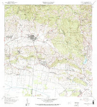
1966 Map of Sabana Grande
USGS Topo · Published 1969About this map
Sabana Grande sits at a geographic crossroads between the mountain forests and the fertile southern valleys in this mid-1960s topographical survey. The town's urban center is divided into Pueblo Norte and Pueblo Sur, supported by infrastructure like the Planta de Purificación and Planta de Tratamiento de Aguas Negras. To the north, the terrain climbs toward the Bosque Estatal de Maricao, while the southern reaches descend into the Valle de Lajas and Valle de Guanica.
Find a feature on this map
113 named features on this map. Tap any name to fly to it.
Don’t see what you’re looking for? This feature index may not catch every label — zoom into the map to look around manually.
Map Details
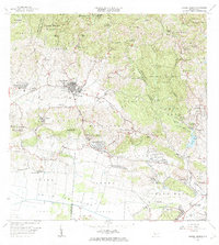
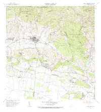
Editions of this 1966 Sabana Grande Map
3 editions found
Other maps of this area

1937 · San German
USGS Topo · 1:25,000

1937 · Sabana Grande
USGS Topo · 1:25,000
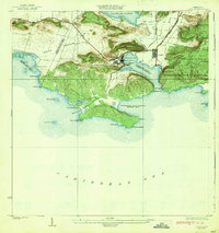
1938 · Guanica
USGS Topo · 1:30,000

1938 · Parguera
USGS Topo · 1:30,000

1941 · San German
USGS Topo · 1:30,000

1941 · Sabana Grande
USGS Topo · 1:30,000

1941 · Rosario
USGS Topo · 1:30,000

1942 · Rosario
USGS Topo · 1:30,000

1946 · Maricao
USGS Topo · 1:30,000

1946 · Yauco
USGS Topo · 1:30,000
Featured Places
- Sabana Grande, Sabana Grande
- Sector Río Loco, Yauco
- Sector El Puente, Sabana Grande
- Sector Papayo, Sabana Grande
- Sector Facio, Yauco