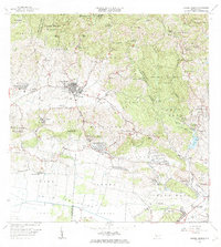
1966 Map of Sabana Grande
USGS Topo · Published 1969About this map
Sabana Grande serves as the focal point of this southwestern Puerto Rico landscape, divided into its Pueblo Norte and Pueblo Sur sectors. The town is flanked by a complex network of schools and spiritual sites, including the Capilla del Pozo de la Virgen and the Convento Nuestra Señora de Fátima. The terrain transitions from the protected timberlands of the Bosque Estatal de Maricao in the north to the broad agricultural expanse of the Valle de Lajas in the south.
Find a feature on this map
107 named features on this map. Tap any name to fly to it.
Don’t see what you’re looking for? This feature index may not catch every label — zoom into the map to look around manually.
Map Details
Editions of this 1966 Sabana Grande Map
3 editions found
Other maps of this area

1937 · San German
USGS Topo · 1:25,000

1937 · Sabana Grande
USGS Topo · 1:25,000

1938 · Guanica
USGS Topo · 1:30,000

1938 · Parguera
USGS Topo · 1:30,000

1941 · San German
USGS Topo · 1:30,000

1941 · Sabana Grande
USGS Topo · 1:30,000

1941 · Rosario
USGS Topo · 1:30,000

1942 · Rosario
USGS Topo · 1:30,000

1946 · Maricao
USGS Topo · 1:30,000

1946 · Yauco
USGS Topo · 1:30,000
Featured Places
- Sabana Grande
- Sector Río Loco, Yauco
- Sector El Puente, Sabana Grande
- Sector Papayo, Sabana Grande
- Sector Facio, Yauco