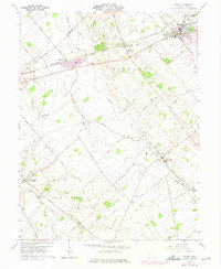
1961 Map of Sabina
USGS Topo · Published 1975About this map
The Penn Central and Baltimore and Ohio railroads converge at the town of Sabina, anchoring a landscape defined by 1960s Midwestern agriculture and small-town infrastructure. This survey captures the transition of the region's transport network, from the rail crossings at Melvin to the emerging highway system. Local life is documented through scattered rural landmarks such as the Simon Kenton Sch and the community surrounding Lees Creek.
Find a feature on this map
62 named features on this map. Tap any name to fly to it.
Don’t see what you’re looking for? This feature index may not catch every label — zoom into the map to look around manually.
Map Details
Editions of this 1961 Sabina Map
2 editions found
Other maps of this area

1907 · Blanchester
USGS Topo · 1:62,500

1916 · Octa
USGS Topo · 1:62,500

1917 · Xenia
USGS Topo · 1:62,500

1917 · Sabina
USGS Topo · 1:62,500

1943 · Sabina
USGS Topo · 1:62,500

1944 · Octa
USGS Topo · 1:62,500

1947 · Columbus
USGS Topo · 1:250,000

1955 · Port William
USGS Topo · 1:24,000

1960 · Martinsville
USGS Topo · 1:24,000
1960 · Leesburg
USGS Topo · 1:24,000