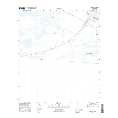
2016 Map of Sabine Pass
USGS Topo · Published 2016About this map
Sabine Pass anchors this coastal landscape where the Texas and Louisiana border meets the Gulf of Mexico. This environment is defined by extensive wetlands and coastal lakes, including Johnson Lake, Salt Lake, and Knight Lake, which separate the settlement from the open water. The town site itself is organized along a traditional grid with streets such as Broadway St and Mechanic St, while the surrounding marshland is traversed by utilitarian paths like the Cattle Walk.
Find a feature on this map
30 named features on this map. Tap any name to fly to it.
Don’t see what you’re looking for? This feature index may not catch every label — zoom into the map to look around manually.
Map Details
Editions of this 2016 Sabine Pass Map
This is the sole edition of this map. No revisions or reprints were ever made.
Other maps of this area

1932 · Sabine Pass NE
USGS Topo · 1:31,680

1943 · West of Johnson Bayou
USGS Topo · 1:24,000

1943 · Port Arthur South
USGS Topo · 1:24,000

1944 · Sabine Pass
USGS Topo · 1:31,680

1944 · Texas Point
USGS Topo · 1:31,680
1946 · Sabine Pass NE
USGS Topo · 1:31,680
1946 · Port Arthur SE
USGS Topo · 1:31,680

1950 · Houston
USGS Topo · 1:250,000

1954 · Port Arthur
USGS Topo · 1:250,000

1956 · Houston
USGS Topo · 1:250,000