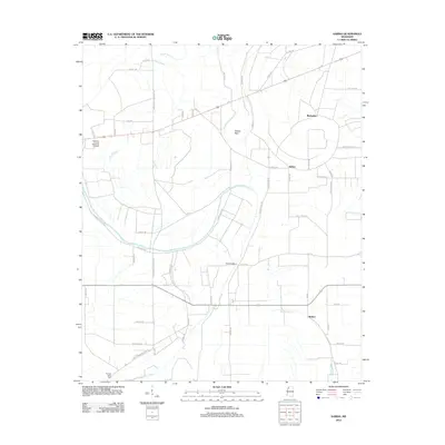
2012 Map of Sabino
USGS Topo · Published 2012About this map
The low-lying Mississippi Delta landscape between Sabino and Walnut is defined by an intricate network of slow-moving waterways and agricultural infrastructure. Sluggish water bodies such as Alcorn Bayou, Walnut Bayou, and Melancholy Bayou snake through the terrain, while the distinctive Oxbow Bend and the Big Cr Deadwater indicate the shifting historical paths of larger river systems. This 2012 survey illustrates a rural region where life is oriented around long-established road networks and scattered settlements like Barksdale. Local landmarks such as Mud Bridge and the Coahoma County Memorial Gardens serve as anchors for the community, alongside the Pleasant Valley Cem located further south. The map reflects the persistent agricultural character of the county, where the drainage of the Delta remains the primary influence on the placement of roads and homesteads.
Find a feature on this map
57 named features on this map. Tap any name to fly to it.
Don’t see what you’re looking for? This feature index may not catch every label — zoom into the map to look around manually.
Map Details
Editions of this 2012 Sabino Map
This is the sole edition of this map. No revisions or reprints were ever made.
Other maps of this area

1908 · Coahoma
USGS Topo · 1:24,000

1908 · Jonestown
USGS Topo · 1:24,000

1910 · Coahoma
USGS Topo · 1:31,680

1910 · Jonestown
USGS Topo · 1:31,680

1932 · Tutwiler
USGS Topo · 1:48,000

1932 · Marks
USGS Topo · 1:48,000

1935 · Clarksdale
USGS Topo · 1:62,500

1935 · Marks
USGS Topo · 1:62,500

1935 · Tutwiler
USGS Topo · 1:62,500

1939 · Farrell
USGS Topo · 1:62,500