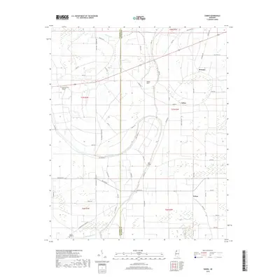
2018 Map of Sabino
USGS Topo · Published 2018About this map
Walnut Bayou and the winding course of Alcorn Bayou define this Mississippi Delta landscape along the border of Coahoma and Quitman counties. The terrain is characterized by intricate water systems, including the dramatic Oxbow Bend and the Big Creek Deadwater, which reflect the region's alluvial history and drainage patterns. Small settlements and rural hubs such as Walnut, Sabino, and Barksdale are connected by a network of local roads like Sabino Rd and Belview Rd, illustrating the persistent agricultural character of the area.
Find a feature on this map
55 named features on this map. Tap any name to fly to it.
Don’t see what you’re looking for? This feature index may not catch every label — zoom into the map to look around manually.
Map Details
Editions of this 2018 Sabino Map
This is the sole edition of this map. No revisions or reprints were ever made.
Other maps of this area

1908 · Coahoma
USGS Topo · 1:24,000

1908 · Jonestown
USGS Topo · 1:24,000

1910 · Coahoma
USGS Topo · 1:31,680

1910 · Jonestown
USGS Topo · 1:31,680

1932 · Tutwiler
USGS Topo · 1:48,000

1932 · Marks
USGS Topo · 1:48,000

1935 · Clarksdale
USGS Topo · 1:62,500

1935 · Marks
USGS Topo · 1:62,500

1935 · Tutwiler
USGS Topo · 1:62,500

1939 · Farrell
USGS Topo · 1:62,500