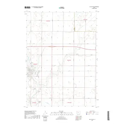
2018 Map of Sac City East
USGS Topo · Published 2018About this map
Sac City serves as the focal point for this rural landscape in north-central Iowa, situated along the winding course of the North Raccoon River. The town's grid expands toward the riverbanks, where the Sac City Municipal Airport anchors the southern outskirts. Outside the municipal limits, the terrain is defined by a dense network of sectional roads and the serpentine path of Cedar Creek, which carves through the undulating farmland. Local genealogy and settlement history are preserved at Oakland Cem, Cedar Cem, and Cory Grove Cem, which mark the community's legacy across the countryside. The presence of Drainage Ditch 73 and Prairie Cr highlight the region's managed agricultural landscape, showing the systematic transformation of the prairie into a productive agricultural engine during the early 21st century.
Find a feature on this map
51 named features on this map. Tap any name to fly to it.
Don’t see what you’re looking for? This feature index may not catch every label — zoom into the map to look around manually.
Map Details
Editions of this 2018 Sac City East Map
This is the sole edition of this map. No revisions or reprints were ever made.
Other maps of this area

1954 · Fort Dodge
USGS Topo · 1:250,000

1957 · Fort Dodge
USGS Topo · 1:250,000

1958 · Fort Dodge
USGS Topo · 1:250,000

1979 · Fonda
USGS Topo · 1:24,000

1979 · Newell West
USGS Topo · 1:24,000

1979 · Newell East
USGS Topo · 1:24,000

1980 · Lytton
USGS Topo · 1:24,000

1980 · Sac City East
USGS Topo · 1:24,000

1980 · Grant City
USGS Topo · 1:24,000

1980 · Yetter
USGS Topo · 1:24,000