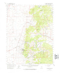
1959 Map of Sacramento Pass
USGS Topo · Published 1970About this map
Osceola and the high peaks of the Snake Range anchor this 1959 survey of White Pine County. The map documents a landscape defined by its mining heritage and water scarcity, noting the Crystal Queen Mine Water source and the settlement at Hogum. While Spring Valley dominates the west, the eastern terrain climbs steeply through the Humboldt National Forest, where alpine features like Stella Lake and Blue Lake sit beneath Buck Mtn.
Find a feature on this map
92 named features on this map. Tap any name to fly to it.
Don’t see what you’re looking for? This feature index may not catch every label — zoom into the map to look around manually.
Map Details
Editions of this 1959 Sacramento Pass Map
3 editions found
Other maps of this area

1948 · Wheeler Peak
USGS Topo · 1:62,500

1949 · Garrison
USGS Topo · 1:62,500

1950 · Wheeler Peak
USGS Topo · 1:62,500

1951 · Garrison
USGS Topo · 1:62,500

1952 · Ely
USGS Topo · 1:125,000

1956 · Lund
USGS Topo · 1:250,000

1956 · Ely
USGS Topo · 1:250,000

1959 · Ely
USGS Topo · 1:250,000

1959 · Sacramento Pass
USGS Topo · 1:62,500

1959 · Connors Pass
USGS Topo · 1:62,500