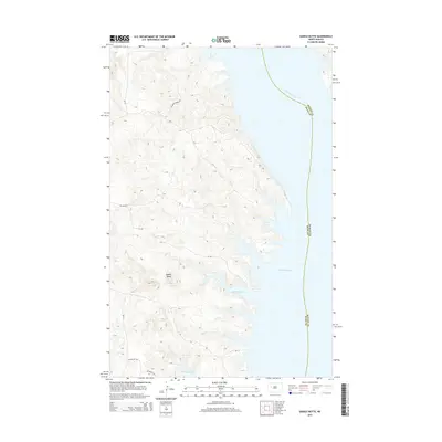
2014 Map of Saddle Butte
USGS Topo · Published 2014About this map
Lake Sakakawea dominates the eastern landscape of this 2014 survey, where the waters of the impounded Missouri River meet the intricate, eroded shorelines of Dunn and McLean Counties. The terrain is characterized by the prominent Saddle Butte, which rises above a network of Bureau of Indian Affairs routes and local access roads. The jagged western edge of the reservoir is marked by deep inlets, most notably Saddle Butte Bay and the northern reaches of McKenzie Bay. Local landmarks such as Charging Family Rd reflect the specific human geography of the area. This map illustrates the transition from the high, dissected plains down to the expansive reservoir system, showing the primary transport corridors like BIA Route 21 and Bia-13 that navigate the ridges above the water.
Find a feature on this map
14 named features on this map. Tap any name to fly to it.
Don’t see what you’re looking for? This feature index may not catch every label — zoom into the map to look around manually.
Map Details
Editions of this 2014 Saddle Butte Map
This is the sole edition of this map. No revisions or reprints were ever made.
Other maps of this area

1953 · Watford City
USGS Topo · 1:250,000

1957 · Watford City
USGS Topo · 1:250,000

1967 · Watford City
USGS Topo · 1:250,000

1967 · Raub NW
USGS Topo · 1:24,000

1967 · Twin Buttes
USGS Topo · 1:24,000

1967 · New Town SW
USGS Topo · 1:24,000

1967 · Parshall SW
USGS Topo · 1:24,000

1967 · New Town SE
USGS Topo · 1:24,000

1970 · Hay Flat
USGS Topo · 1:24,000

1970 · String Buttes
USGS Topo · 1:24,000