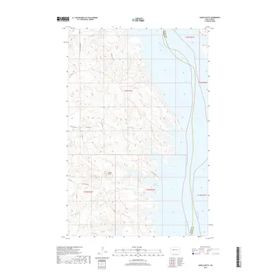
2018 Map of Saddle Butte
USGS Topo · Published 2018About this map
Lake Sakakawea and the winding Missouri River define this North Dakota landscape along the boundary of Dunn Co and McLean Co. The area is characterized by the high ground of Saddle Butte, which overlooks the expansive waters of Saddle Butte Bay. The road network provides evidence of local family heritage and community infrastructure, with names like Charging Family Rd, Jim Hale Rd, and Hale Marina Rd marking the terrain. These routes, alongside several Bureau of Indian Affairs roads such as BIA Rd 13 and BIA Rte 12, connect the rugged shoreline to the interior highlands. This survey documents the intersection of modern water management and traditional land divisions in the heart of the Missouri River basin.
Find a feature on this map
19 named features on this map. Tap any name to fly to it.
Don’t see what you’re looking for? This feature index may not catch every label — zoom into the map to look around manually.
Map Details
Editions of this 2018 Saddle Butte Map
This is the sole edition of this map. No revisions or reprints were ever made.
Other maps of this area

1953 · Watford City
USGS Topo · 1:250,000

1957 · Watford City
USGS Topo · 1:250,000

1967 · Watford City
USGS Topo · 1:250,000

1967 · Raub NW
USGS Topo · 1:24,000

1967 · Twin Buttes
USGS Topo · 1:24,000

1967 · New Town SW
USGS Topo · 1:24,000

1967 · Parshall SW
USGS Topo · 1:24,000

1967 · New Town SE
USGS Topo · 1:24,000

1970 · Hay Flat
USGS Topo · 1:24,000

1970 · String Buttes
USGS Topo · 1:24,000