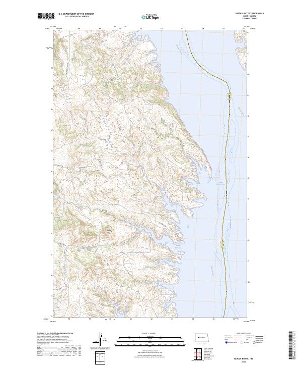
2024 Map of Saddle Butte
USGS Topo · Published 2024About this map
Saddle Butte rises as a prominent landmark overlooking the expansive waters of Lake Sakakawea along the eastern edge of Dunn County. This 2024 survey documents the contemporary geography where the Missouri River flows into the reservoir, creating deep inlets such as Saddle Butte Bay. The landscape is defined by the high, broken terrain of the Missouri Plateau, marked by a network of rural roads that frequently bear family and community names, suggesting deep-rooted local heritage and tribal land associations within the Fort Berthold area.
Find a feature on this map
19 named features on this map. Tap any name to fly to it.
Don’t see what you’re looking for? This feature index may not catch every label — zoom into the map to look around manually.
Map Details
Editions of this 2024 Saddle Butte Map
This is the sole edition of this map. No revisions or reprints were ever made.
Other maps of this area

1953 · Watford City
USGS Topo · 1:250,000

1957 · Watford City
USGS Topo · 1:250,000

1967 · Watford City
USGS Topo · 1:250,000

1967 · Raub NW
USGS Topo · 1:24,000

1967 · Twin Buttes
USGS Topo · 1:24,000

1967 · New Town SW
USGS Topo · 1:24,000

1967 · Parshall SW
USGS Topo · 1:24,000

1967 · New Town SE
USGS Topo · 1:24,000

1970 · Hay Flat
USGS Topo · 1:24,000

1970 · String Buttes
USGS Topo · 1:24,000