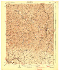
1939 Map of Sadieville
USGS Topo · Published 1939About this map
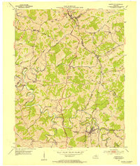
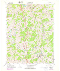
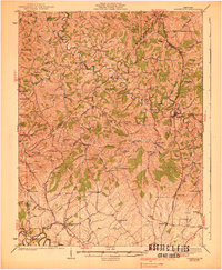
Eagle Creek snakes through the center of this terrain, defining a landscape of deeply etched stream valleys and rural ridges across Scott, Owen, and Harrison counties. The Southern Railway corridor anchors the eastern side of the map, serving Sadieville and Corinth, while the Frankfort and Cincinnati RR cuts across the southern portion near Stamping Ground. This survey reveals a dense network of country schools and churches that once served as the social centers for upland farming families, including Zion Hill Ch and the Locust Grove Sch. A notable topographical feature is Mountain Island, a dramatic loop where the creek nearly doubles back on itself. The presence of the Dixie Highway running north-south highlights the transition to modern automobile travel during the late 1930s, even as many roads remained unpaved between isolated settlements like New Columbus and Minorsville.
Find a feature on this map
77 named features on this map. Tap any name to fly to it.
Don’t see what you’re looking for? This feature index may not catch every label — zoom into the map to look around manually.
Map Details
Editions of this 1939 Sadieville Map
2 editions found
Historical Maps of Georgetown Through Time
8 maps found