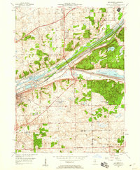
1953 Map of Sag Bridge
USGS Topo · Published 1960About this map
The industrial and institutional landscape of southwestern Cook County is defined here by the confluence of the Des Plaines River and two major man-made waterways. The Chicago Sanitary and Ship Canal and the older Illinois and Michigan Canal run parallel through the valley, creating a corridor of transport that historically fueled the growth of Lemont and Sag Bridge. To the north, the sprawling Argonne National Laboratory Reservation occupies a massive footprint, reflecting the Cold War era's scientific expansion into the suburbs.
Find a feature on this map
64 named features on this map. Tap any name to fly to it.
Don’t see what you’re looking for? This feature index may not catch every label — zoom into the map to look around manually.
Map Details
Editions of this 1953 Sag Bridge Map
2 editions found
Other maps of this area

1890 · Des Plaines
USGS Topo · 1:62,500

1891 · Riverside
USGS Topo · 1:62,500

1892 · Joliet
USGS Topo · 1:62,500

1893 · Riverside
USGS Topo · 1:62,500

1894 · Des Plaines
USGS Topo · 1:62,500

1900 · Des Plaines
USGS Topo · 1:62,500

1900 · Riverside
USGS Topo · 1:62,500

1901 · Des Plaines
USGS Topo · 1:62,500

1901 · Riverside
USGS Topo · 1:62,500

1908 · Wheaton
USGS Topo · 1:62,500