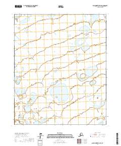
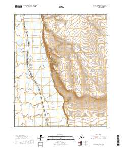
2017 Map of Sagavanirktok D-4 SE
USGS Topo · Published 2017About this map
Hydrological patterns and permafrost features dominate this Arctic landscape within the North Slope Borough, where the vast majority of the terrain is defined by complex wetland systems. Surveyed by the U.S. Geological Survey using satellite imagery from 2010 and hydrography data updated through 2016, the map reveals a remote wilderness devoid of established roads or permanent settlements. The sheet is primarily organized by the Public Land Survey System grid, covering portions of T6n R12e, T6n R13e, T5n R12e, and T5n R13e. The density of thaw lakes and ponds illustrates a landscape in constant flux, where small water bodies and marshy lowlands create a non-linear network across the tundra, providing critical data for researchers tracking environmental changes in the northernmost reaches of Alaska.
Find a feature on this map
4 named features on this map. Tap any name to fly to it.
Don’t see what you’re looking for? This feature index may not catch every label — zoom into the map to look around manually.
Map Details
Editions of this 2017 Sagavanirktok D-4 SE Map
This is the sole edition of this map. No revisions or reprints were ever made.
Other maps of this area

1951 · Sagavanirktok D-5
USGS Topo · 1:250,000

1955 · Sagavanirktok D-3
USGS Topo · 1:63,360

1955 · Sagavanirktok D-4
USGS Topo · 1:63,360

1956 · Sagavanirktok
USGS Topo · 1:250,000

1958 · Sagavanirktok
USGS Topo · 1:250,000

1964 · Sagavanirktok
USGS Topo · 1:250,000
1971 · Sagavanirktok C-3
USGS Topo · 1:63,360
1971 · Sagavanirktok C-4
USGS Topo · 1:63,360
2017 · Sagavanirktok D-3 NW
USGS Topo · 1:25,000
2017 · Sagavanirktok D-3 SW
USGS Topo · 1:25,000