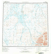
1956 Map of Sagavanirktok
USGS Topo · Published 1968About this map
The Sagavanirktok River and its expansive braiding dominate this 1950s landscape, illustrating a complex hydrological system flowing north toward the Arctic coast. The presence of the Tractor Trail and Winter Trail reveals the ephemeral nature of transportation in this region, where seasonal paths were often the only means of traversing the tundra. High ground is marked by the White Hills and Franklin Bluffs, which provide topographical contrast to the low-lying river basins.
Find a feature on this map
51 named features on this map. Tap any name to fly to it.
Don’t see what you’re looking for? This feature index may not catch every label — zoom into the map to look around manually.
Map Details
Editions of this 1956 Sagavanirktok Map
5 editions found

Other maps of this area

1951 · Harrison Bay
USGS Topo · 1:250,000

1951 · Beechey Point
USGS Topo · 1:250,000

1951 · Sagavanirktok D-5
USGS Topo · 1:250,000

1951 · Chandler Lake
USGS Topo · 1:250,000

1951 · Brooks
USGS Topo · 1:250,000

1951 · Arctic
USGS Topo · 1:250,000

1951 · Mt. Michelson
USGS Topo · 1:250,000

1952 · Umiat
USGS Topo · 1:250,000

1955 · Flaxman Island
USGS Topo · 1:250,000

1955 · Harrison Bay
USGS Topo · 1:250,000