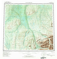
1956 Map of Sagavanirktok
USGS Topo · Published 1968About this map
The Sagavanirktok River dominates this mid-century view of Alaska's North Slope, flowing north toward the Beaufort Sea through a landscape defined by braided river systems and expansive tundra. Surveyed in the 1950s, the map illustrates the transition from the high peaks of the Brooks Range foothills, including Kakukturat Mtn, down to the prominent Franklin Bluffs along the river's eastern bank. Evidence of early remote exploration is visible through the notation of a Tractor Trail crossing the White Hills and a Winter Trail cutting through the northeast. These paths suggest the seasonal nature of movement in this territory before permanent infrastructure was established. Significant tributaries like the Kuparuk River, Ivishak River, and Lupine River carve through the terrain, highlighting the complex drainage patterns that characterize this Arctic environment during the summer melt.
Find a feature on this map
23 named features on this map. Tap any name to fly to it.
Don’t see what you’re looking for? This feature index may not catch every label — zoom into the map to look around manually.
Map Details
Editions of this 1956 Sagavanirktok Map
5 editions found

Other maps of this area

1951 · Harrison Bay
USGS Topo · 1:250,000

1951 · Beechey Point
USGS Topo · 1:250,000

1951 · Sagavanirktok D-5
USGS Topo · 1:250,000

1951 · Chandler Lake
USGS Topo · 1:250,000

1951 · Brooks
USGS Topo · 1:250,000

1951 · Arctic
USGS Topo · 1:250,000

1951 · Mt. Michelson
USGS Topo · 1:250,000

1952 · Umiat
USGS Topo · 1:250,000

1955 · Flaxman Island
USGS Topo · 1:250,000

1955 · Harrison Bay
USGS Topo · 1:250,000