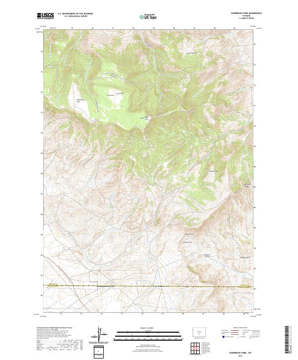
2021 Map of Sagebrush Park
USGS Topo · Published 2021About this map
Green Mtn and the surrounding high-altitude plateaus dominate this section of central Wyoming, where the Continental Divide National Scenic Trl crosses the southern reaches of the map. The landscape is characterized by a series of elevated flats and drainages, including Sagebrush Park, Little Long Park, and East Cottonwood Park. These natural basins are carved by seasonal watercourses like Crooks Cr and Lost Soldier Cr, reflecting a traditional western ranching and grazing environment where water sources and topographic shelter dictate land use.
Find a feature on this map
33 named features on this map. Tap any name to fly to it.
Don’t see what you’re looking for? This feature index may not catch every label — zoom into the map to look around manually.
Map Details
Editions of this 2021 Sagebrush Park Map
This is the sole edition of this map. No revisions or reprints were ever made.
Other maps of this area

1951 · Crooks Creek NE
USGS Topo · 1:24,000

1951 · Split Rock
USGS Topo · 1:24,000

1951 · Split Rock NW
USGS Topo · 1:24,000

1955 · Casper
USGS Topo · 1:250,000

1957 · Jeffrey City
USGS Topo · 1:24,000

1958 · Casper
USGS Topo · 1:250,000
1961 · Osborne Well
USGS Topo · 1:24,000

1961 · Hadsell Spring
USGS Topo · 1:24,000

1961 · Crooks Peak
USGS Topo · 1:24,000

1961 · Bairoil
USGS Topo · 1:24,000