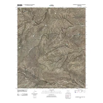
2010 Map of Sagebrush Valley East
USGS Topo · Published 2010About this map
Rio Felix and Eagle Creek carve through this section of Chaves County, defining a landscape marked by intermittent water sources and ranching infrastructure. The presence of the Runyan Ranch in the north and McAshan Ranch to the south suggests the enduring importance of large-scale pastoral operations in this arid region. A network of primitive and local roads, including Squaw Canyon RD and the curious No Where RD, provides access to several water storage features such as CCC Tank, Dutch Tank, and Young Tank. These tanks and wells like Nester Well are critical markers for anyone tracing the history of land use and cattle grazing. The terrain is further etched by numerous drainages, notably Johnson Draw, Hackberry Draw, and Goaty Canyon, illustrating the complex watershed of the Sagebrush Valley before it meets the larger plains to the east.
Find a feature on this map
25 named features on this map. Tap any name to fly to it.
Don’t see what you’re looking for? This feature index may not catch every label — zoom into the map to look around manually.
Map Details
Editions of this 2010 Sagebrush Valley East Map
This is the sole edition of this map. No revisions or reprints were ever made.
Other maps of this area

1954 · Carlsbad
USGS Topo · 1:250,000

1955 · Hope NW
USGS Topo · 1:24,000

1955 · Kincaid Ranch
USGS Topo · 1:24,000

1955 · Hope
USGS Topo · 1:24,000

1955 · Roswell
USGS Topo · 1:250,000

1956 · Hope
USGS Topo · 1:24,000

1958 · Carlsbad
USGS Topo · 1:250,000

1958 · Roswell
USGS Topo · 1:250,000

1960 · Teel Ranch
USGS Topo · 1:62,500

1961 · Indian Bluff
USGS Topo · 1:62,500