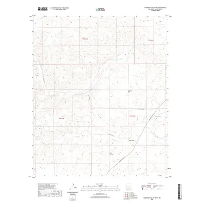
2020 Map of Sagebrush Valley West
USGS Topo · Published 2020About this map
Sagebrush Valley and its surrounding high desert landscape are defined by a complex network of seasonal drainages and canyons within Chaves County. The Rio Felix meanders across the northern sections, while further south, the terrain is carved by Eagle Canyon and the Singer Lake Draw. These geographical features dictate the path of local transit, with Felix Canyon Rd and Sagebrush Valley Rd following the natural contours of the land to connect the scattered ranchlands. The topography is marked by significant elevation changes, particularly around Goaty Canyon and the headwaters of Eagle Cr, illustrating the drainage patterns that flow toward the Pecos River basin. This survey provides a clear view of the modern land management boundaries, including Township 15 and 16 South, established by the U.S. Geological Survey.
Find a feature on this map
13 named features on this map. Tap any name to fly to it.
Don’t see what you’re looking for? This feature index may not catch every label — zoom into the map to look around manually.
Map Details
Editions of this 2020 Sagebrush Valley West Map
This is the sole edition of this map. No revisions or reprints were ever made.
Other maps of this area

1954 · Carlsbad
USGS Topo · 1:250,000

1955 · Roswell
USGS Topo · 1:250,000

1958 · Carlsbad
USGS Topo · 1:250,000

1958 · Roswell
USGS Topo · 1:250,000

1960 · Teel Ranch
USGS Topo · 1:62,500

1961 · Flying H
USGS Topo · 1:62,500

1961 · Indian Bluff
USGS Topo · 1:62,500

1962 · Roswell
USGS Topo · 1:250,000

1962 · Dunken
USGS Topo · 1:62,500

1978 · Artesia
USGS Topo · 1:100,000