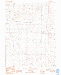
1991 Map of Sagers Flat
USGS Topo · Published 1991About this map
An industrial and transit corridor defines this corner of Grand County, where the desert landscape is marked by the legacy of early transportation and resource extraction. The Old Railroad Grade cuts a linear path across the north, while a modern Pipeline runs parallel to the south, highlighting the area's continued role as a throughway for commerce. The terrain is dominated by wide, dry expanses like Sagers Flat and Elba Flat, which are deeply incised by a network of drainage systems including Salt Wash, Yellow Cat Wash, and Sagers Wash. Numerous Drill Holes scattered throughout the territory suggest a history of geological exploration and prospecting in this arid environment during the mid-to-late twentieth century.
Find a feature on this map
15 named features on this map. Tap any name to fly to it.
Don’t see what you’re looking for? This feature index may not catch every label — zoom into the map to look around manually.
Map Details
Editions of this 1991 Sagers Flat Map
This is the sole edition of this map. No revisions or reprints were ever made.
Other maps of this area

1885 · East Tavaputs
USGS Topo · 1:250,000

1885 · La Sal
USGS Topo · 1:250,000

1956 · Moab
USGS Topo · 1:250,000

1956 · Grand Junction
USGS Topo · 1:250,000

1958 · Thompson
USGS Topo · 1:62,500

1958 · Cisco
USGS Topo · 1:62,500

1959 · Grand Junction
USGS Topo · 1:250,000

1959 · Moab
USGS Topo · 1:250,000

1960 · Moab
USGS Topo · 1:250,000

1960 · Grand Junction
USGS Topo · 1:250,000