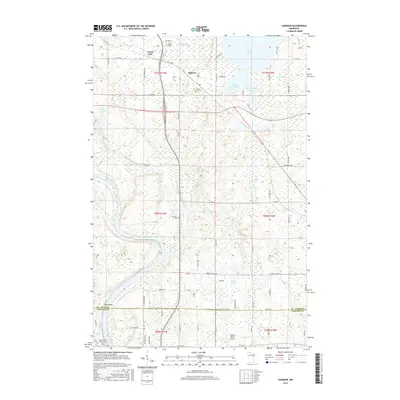
2016 Map of Saginaw
USGS Topo · Published 2016About this map
The Saint Louis River and its meandering channel define the southern landscape of this northern Minnesota region, where the township lines of St. Louis and Carlton counties meet. The settlement of Saginaw serves as a central point for a network of local routes including Saginaw Rd and Maki Rd, while the smaller community of Brevator sits to the south near its namesake Brevator Cem. This era shows a mix of recreational and residential development surrounding Grand Lake, Little Grand Lake, and Baby Grand Lake, alongside infrastructure such as the Country Haven Airport and Swan Field. The hydrography is particularly dense here, featuring the Pine River, Dutch Slough, and Beartrap Cr. Researchers will find significant genealogical interest in the Holy Family Cemeteries located near the southern boundary, as well as the distinct geographic feature of Pine Island nestled between the river forks.
Find a feature on this map
79 named features on this map. Tap any name to fly to it.
Don’t see what you’re looking for? This feature index may not catch every label — zoom into the map to look around manually.
Map Details
Editions of this 2016 Saginaw Map
This is the sole edition of this map. No revisions or reprints were ever made.
Other maps of this area

1953 · Twig
USGS Topo · 1:24,000

1953 · Saginaw
USGS Topo · 1:24,000

1953 · Adolph
USGS Topo · 1:24,000

1953 · Alborn
USGS Topo · 1:24,000

1953 · Brookston
USGS Topo · 1:24,000

1953 · Independence
USGS Topo · 1:24,000

1953 · Duluth
USGS Topo · 1:250,000

1954 · Cloquet
USGS Topo · 1:24,000

1954 · Esko
USGS Topo · 1:24,000

1954 · Iverson
USGS Topo · 1:24,000