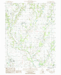
1985 Map of Sailor Springs
USGS Topo · Published 1985About this map
Sailor Springs and its surrounding countryside in the mid-1980s are defined by the intricate dendritic drainage systems of the Wabash River basin. The village of Sailor Springs serves as a southern anchor, located near the confluence of Spring Branch and Big Muddy Creek. This landscape is deeply etched by water, with Limestone Creek, Hurricane Creek, and Wet Weather Creek carving through the agricultural townships of Bible Grove, South Muddy, and Pixley.
Find a feature on this map
27 named features on this map. Tap any name to fly to it.
Don’t see what you’re looking for? This feature index may not catch every label — zoom into the map to look around manually.
Map Details
Editions of this 1985 Sailor Springs Map
This is the sole edition of this map. No revisions or reprints were ever made.
Other maps of this area

1941 · Newton
USGS Topo · 1:62,500

1943 · Newton
USGS Topo · 1:62,500

1948 · Flora
USGS Topo · 1:62,500

1949 · Olney
USGS Topo · 1:62,500

1949 · Flora
USGS Topo · 1:62,500

1953 · Sailor Springs
USGS Topo · 1:62,500

1958 · Belleville
USGS Topo · 1:250,000

1962 · Belleville
USGS Topo · 1:250,000

1970 · Clay City
USGS Topo · 1:24,000
1970 · Flora
USGS Topo · 1:24,000