
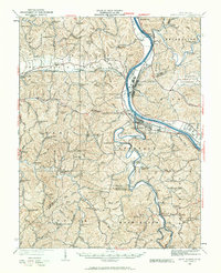
1931 Map of Saint Albans
USGS Topo · Published 1931About this map
Saint Albans and Nitro anchor this early 1930s landscape at the confluence of the Kanawha River and the Pocatalico River. The region reflects a transition from rural ridge-and-valley farming to industrial riverfront activity, with the Chesapeake and Ohio railroad corridor facilitating trade through Scott Depot and Sattes. The industrial character of Nitro, established just over a decade prior to this revision, is contrasted by the numerous small community schools dotting the interior hills, such as the curiously named Seldom Seen School, Big Scary School, and Alberta School.
Find a feature on this map
156 named features on this map. Tap any name to fly to it.
Don’t see what you’re looking for? This feature index may not catch every label — zoom into the map to look around manually.
Map Details
Editions of this 1931 Saint Albans Map
2 editions found
Other maps of this area

1892 · Huntington
USGS Topo · 1:125,000

1898 · Huntington
USGS Topo · 1:125,000

1899 · Charleston
USGS Topo · 1:125,000

1902 · Milton
USGS Topo · 1:62,500

1902 · Midkiff
USGS Topo · 1:62,500

1906 · Glenwood
USGS Topo · 1:62,500

1906 · Kenna
USGS Topo · 1:62,500

1906 · Winfield
USGS Topo · 1:62,500

1907 · Kenna
USGS Topo · 1:62,500

1907 · Midkiff
USGS Topo · 1:62,500