
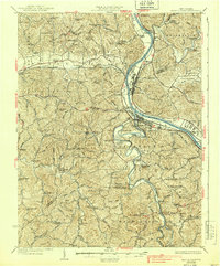
1933 Map of Saint Albans
USGS Topo · Published 1933About this map
The Kanawha River and Pocatalico River define the industrial and residential landscape of this West Virginia corridor during the early 1930s. The heavy industrial footprint of the U S Naval Ordnance Plant and the town of Nitro stand in contrast to the rural, school-dotted hollows of Curry and Duval districts. Rail transport is central to the area's development, with the Chesapeake and Ohio and New York Central lines serving established hubs like Saint Albans and Scott Depot.
Find a feature on this map
113 named features on this map. Tap any name to fly to it.
Don’t see what you’re looking for? This feature index may not catch every label — zoom into the map to look around manually.
Map Details
Editions of this 1933 Saint Albans Map
2 editions found
Other maps of this area

1892 · Huntington
USGS Topo · 1:125,000

1898 · Huntington
USGS Topo · 1:125,000

1899 · Charleston
USGS Topo · 1:125,000

1902 · Milton
USGS Topo · 1:62,500

1902 · Midkiff
USGS Topo · 1:62,500

1906 · Glenwood
USGS Topo · 1:62,500

1906 · Kenna
USGS Topo · 1:62,500

1906 · Winfield
USGS Topo · 1:62,500

1907 · Kenna
USGS Topo · 1:62,500

1907 · Midkiff
USGS Topo · 1:62,500