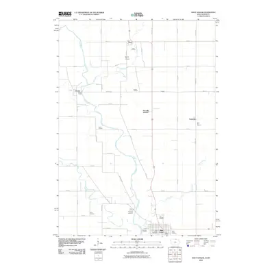
2010 Map of Saint Ansgar
USGS Topo · Published 2010About this map
The Cedar River flows southward through Mitchell County, Iowa, defining the rural character of this northern borderland near Mona. This landscape is marked by a network of small agricultural hubs and historical burial grounds, including the Saint Ansgar Cemetery and the McKinley Cemetery located south of the town center. The settlement of Saint Ansgar serves as a primary focal point, anchored by the Saint Ansgar Post Office and nearby recreational spaces like Acorn Park Golf and Recreation.
Find a feature on this map
43 named features on this map. Tap any name to fly to it.
Don’t see what you’re looking for? This feature index may not catch every label — zoom into the map to look around manually.
Map Details
Editions of this 2010 Saint Ansgar Map
This is the sole edition of this map. No revisions or reprints were ever made.
Other maps of this area

1954 · Hayward
USGS Topo · 1:62,500

1954 · Austin
USGS Topo · 1:62,500

1954 · Mason City
USGS Topo · 1:250,000

1957 · Mason City
USGS Topo · 1:250,000

1958 · Mason City
USGS Topo · 1:250,000

1972 · Osage
USGS Topo · 1:24,000

1972 · St. Ansgar
USGS Topo · 1:24,000

1972 · Osage SW
USGS Topo · 1:24,000
1972 · Stacyville
USGS Topo · 1:24,000
1972 · Grafton
USGS Topo · 1:24,000