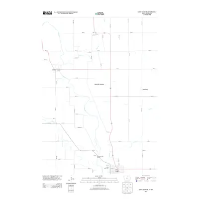
2013 Map of Saint Ansgar
USGS Topo · Published 2013About this map
The Cedar River winds through this northern Mitchell County landscape, serving as a geographic focal point for the surrounding agricultural communities. Along its banks and tributaries like Otter Cr and Deer Cr, small settlements define the rural character of the region. The city of Saint Ansgar anchors the southern portion of the map, while smaller locales like Mona, Otranto, and Toeterville are linked by a grid of named roads such as Dancer Ave and Glass Ave.
Find a feature on this map
45 named features on this map. Tap any name to fly to it.
Don’t see what you’re looking for? This feature index may not catch every label — zoom into the map to look around manually.
Map Details
Editions of this 2013 Saint Ansgar Map
This is the sole edition of this map. No revisions or reprints were ever made.
Other maps of this area

1954 · Hayward
USGS Topo · 1:62,500

1954 · Austin
USGS Topo · 1:62,500

1954 · Mason City
USGS Topo · 1:250,000

1957 · Mason City
USGS Topo · 1:250,000

1958 · Mason City
USGS Topo · 1:250,000

1972 · Osage
USGS Topo · 1:24,000

1972 · St. Ansgar
USGS Topo · 1:24,000

1972 · Osage SW
USGS Topo · 1:24,000
1972 · Stacyville
USGS Topo · 1:24,000
1972 · Grafton
USGS Topo · 1:24,000