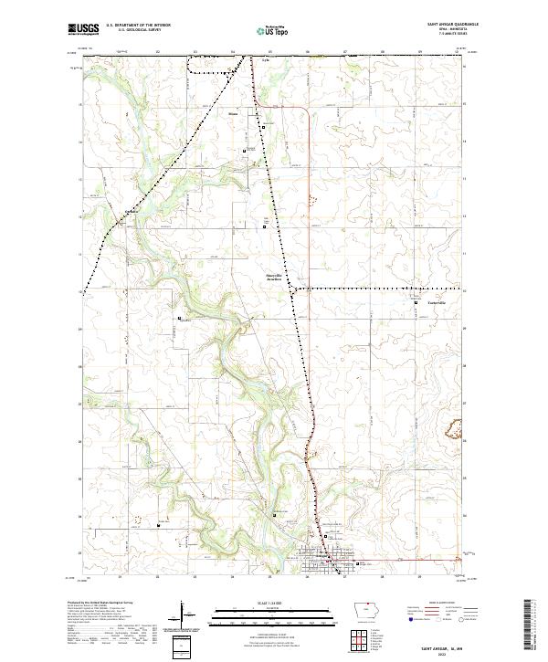
2022 Map of Saint Ansgar
USGS Topo · Published 2022About this map
The Cedar River winds through this northern Iowa landscape, anchoring a series of agricultural communities near the Minnesota border. At the southern end of the sheet, the grid of St. Ansgar serves as a primary hub, characterized by its dense street network including W 4th St and E 5th St. The town is surrounded by important local landmarks for genealogical research, such as First Lutheran Cem and Saint Ansgar Cem.
Find a feature on this map
59 named features on this map. Tap any name to fly to it.
Don’t see what you’re looking for? This feature index may not catch every label — zoom into the map to look around manually.
Map Details
Editions of this 2022 Saint Ansgar Map
This is the sole edition of this map. No revisions or reprints were ever made.
Other maps of this area

1954 · Hayward
USGS Topo · 1:62,500

1954 · Austin
USGS Topo · 1:62,500

1954 · Mason City
USGS Topo · 1:250,000

1957 · Mason City
USGS Topo · 1:250,000

1958 · Mason City
USGS Topo · 1:250,000

1972 · Osage
USGS Topo · 1:24,000

1972 · St. Ansgar
USGS Topo · 1:24,000

1972 · Osage SW
USGS Topo · 1:24,000
1972 · Stacyville
USGS Topo · 1:24,000
1972 · Grafton
USGS Topo · 1:24,000