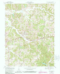
1969 Map of Saint Anthony
USGS Topo · Published 1990About this map
Saint Anthony sits at the heart of this Dubois County landscape, where the Southern railroad line cuts east-to-west through the hills of Jackson and Ferdinand townships. The map reflects a deeply rooted community structure, centered on local institutions like the Sacred Heart Sch and several family-oriented landmarks such as the Bretzville Cem and Cox Cem. These small settlements, including Kyana and Bretzville, are connected by a network of rural routes like South Road, following the natural drainage of Grassy Fork and Richland Creek.
Find a feature on this map
28 named features on this map. Tap any name to fly to it.
Don’t see what you’re looking for? This feature index may not catch every label — zoom into the map to look around manually.
Map Details
Editions of this 1969 Saint Anthony Map
2 editions found
Other maps of this area

1900 · St Meinrad
USGS Topo · 1:62,500

1903 · St. Meinrad
USGS Topo · 1:62,500

1946 · Jasper
USGS Topo · 1:24,000

1954 · Dubois
USGS Topo · 1:24,000

1954 · Huntingburg
USGS Topo · 1:24,000

1955 · Saint Anthony
USGS Topo · 1:24,000

1956 · Vincennes
USGS Topo · 1:250,000

1957 · Vincennes
USGS Topo · 1:250,000

1957 · Cuzco
USGS Topo · 1:24,000

1957 · Birdseye
USGS Topo · 1:24,000