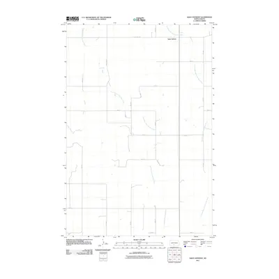
2011 Map of Saint Anthony
USGS Topo · Published 2011About this map
Saint Anthony sits at the northern edge of this Morton County landscape, serving as a focal point for the surrounding rural section lines. The terrain is defined by the winding paths of the South Branch Little Heart River and the Southeast Branch Little Heart River, which meander through the open country. This 2011 survey captures the organized grid of the Great Plains, where established routes like County Rd 136 and County Rd 82 intersect with numbered avenues and streets. The map illustrates a stable agricultural environment where the natural drainage of the Little Heart River branches remains the primary geographic influence on the placement of roads and farmsteads.
Find a feature on this map
17 named features on this map. Tap any name to fly to it.
Don’t see what you’re looking for? This feature index may not catch every label — zoom into the map to look around manually.
Map Details
Editions of this 2011 Saint Anthony Map
This is the sole edition of this map. No revisions or reprints were ever made.
Other maps of this area

1907 · Bismarck
USGS Topo · 1:125,000

1954 · Bismarck
USGS Topo · 1:250,000

1958 · Bismarck
USGS Topo · 1:250,000

1962 · Schmidt
USGS Topo · 1:24,000

1979 · Bismarck
USGS Topo · 1:100,000

1980 · Solen
USGS Topo · 1:24,000
1980 · The Hogback
USGS Topo · 1:24,000

1980 · Breien
USGS Topo · 1:24,000

1980 · Fallon NE
USGS Topo · 1:24,000

1980 · Burgess
USGS Topo · 1:24,000